Viewing Point Clouds
View and analyse LAS and LAZ point clouds in Lunr's browser-based point cloud viewer, with tools for navigation, measurement, clipping, visualisation, saved viewpoints, and scene management.
Overview
A point cloud is a set of 3D points captured from a survey or scan, for example by laser scanning or photogrammetry. Each point records a position in space, and often extra attributes such as colour, laser intensity, and a classification.
Lunr displays LAS and LAZ point clouds directly in the browser using the point cloud viewer, so there is no desktop software to install.
Opening a Point Cloud
Open a point cloud document from the repository the same way as any other document.
If a point cloud is still being prepared for viewing, you may see queued and processing messages, which typically last 1 to 5 minutes. The viewer opens once the cloud is ready. If preparation fails, a message says so and offers a link back to the document details.
Viewer Overview
The viewer fills the browser window, with a toolbar across the top, a rail down the left side that opens the Scenes, Viewpoints, Annotations, Measurements, Clip volumes, and Pins panels, and a bar along the bottom showing the file name, the current colour mode, and keyboard shortcut hints.
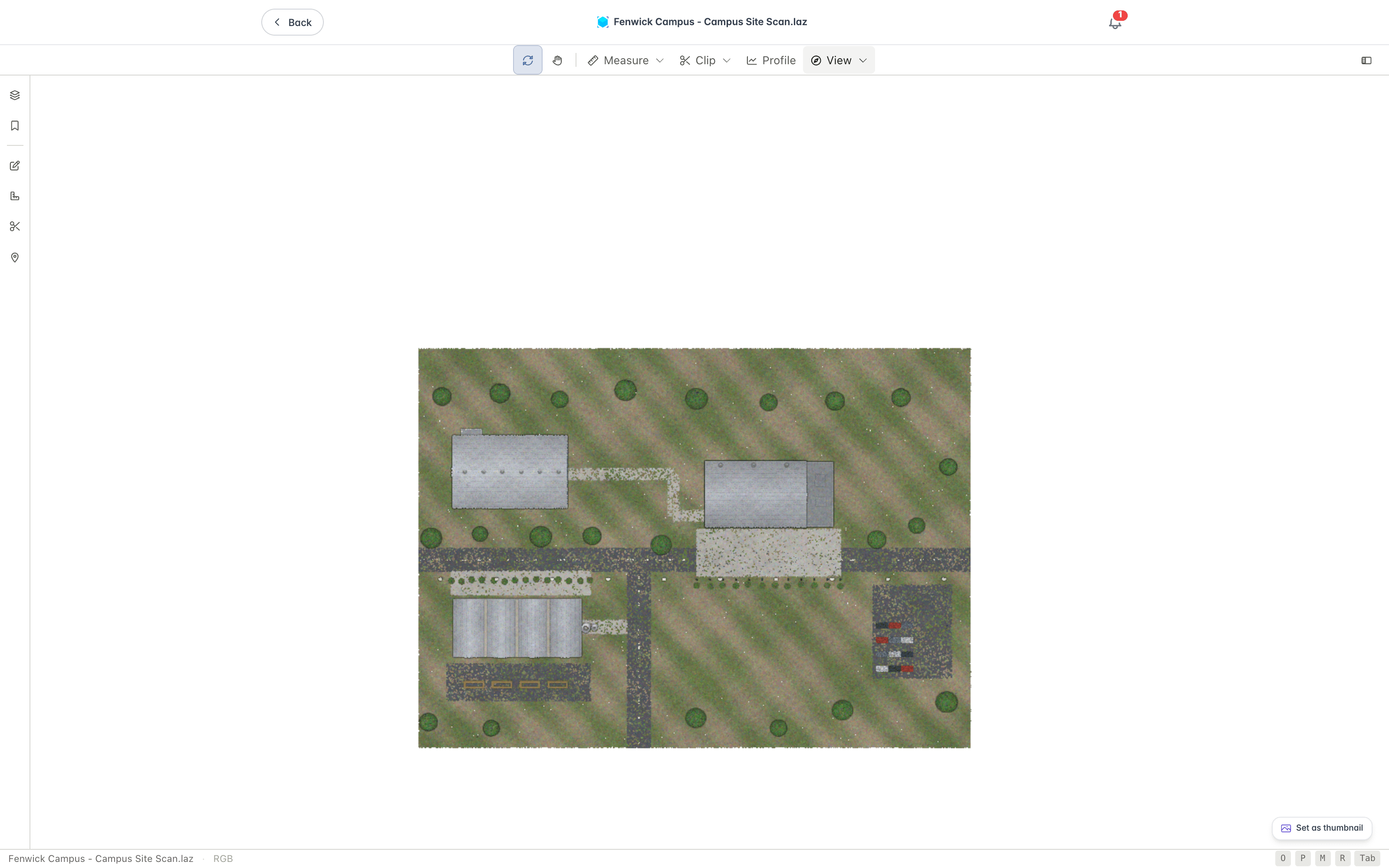
Toolbar
The toolbar holds the tools you use most often.

- The Orbit and Pan navigation tools control how you move around the cloud.
- The Measure, Clip, and View buttons open ribbons of related tools, and Profile extracts a cross-section.
- Settings is the button at the right of the toolbar.
- Colour, background, the light and dark theme, and Screenshot are in the View ribbon, covered below.
Panels
Six panels open from the left rail:
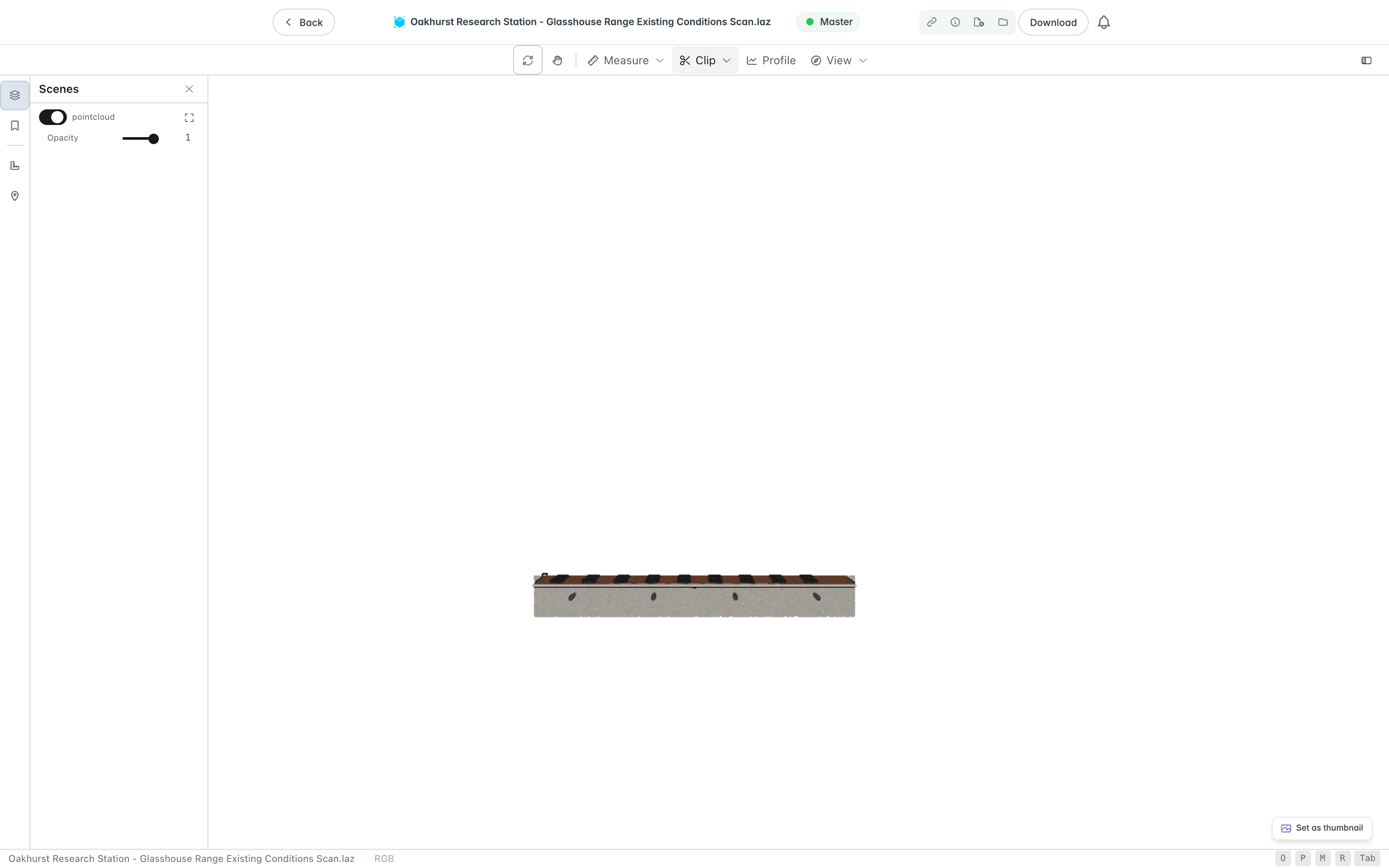
- The Scenes panel lists the point clouds in the document, each with a control to show or hide it, an Opacity slider, and a Zoom to layer button that frames that cloud in the view. Panels open side by side, so you can keep Scenes open while you use another.
- The Viewpoints panel stores camera positions you want to return to.
- The Annotations panel lists the notes, clip areas, and saved views on the cloud, covered under Annotations.
- The Measurements panel lists the measurements you have taken.
- The Clip volumes panel lists the clip volumes and measures what is inside each one, covered under Clip Volumes Panel.
- The Pins panel lists the pin for each note on the cloud, with an option to show or hide the pins in the view, and reads "No pins on this cloud" when there are none.
Navigation
Use the Orbit tool to rotate around the cloud, and the Pan tool to move around the scene.
Open the View ribbon to jump to a preset view, fit the cloud to the screen, or change the camera.

- Orient has Fit, which frames the whole cloud, and the preset views Top, Bottom, Front, Back, Left, and Right.
- Camera switches between Perspective and Orthographic projection. With perspective, a Field of view slider sets the angle, starting at 60 degrees.
- Colour recolours the points, covered under Colouring Points.
- Background sets what sits behind the cloud: Gradient, Black, White, or None.
- Display has Dark Mode, which switches the viewer between light and dark.
- Capture has Screenshot, covered under Capturing a Screenshot.
Colouring Points
The Colour group of the View ribbon recolours the points by attribute:
- RGB shows the true colour captured with the scan.
- Intensity shows the strength of the laser return.
- Elevation shows height.
- Class shows the LAS classification, such as Ground, Building, and Vegetation.
An option is disabled when the cloud does not carry that attribute.
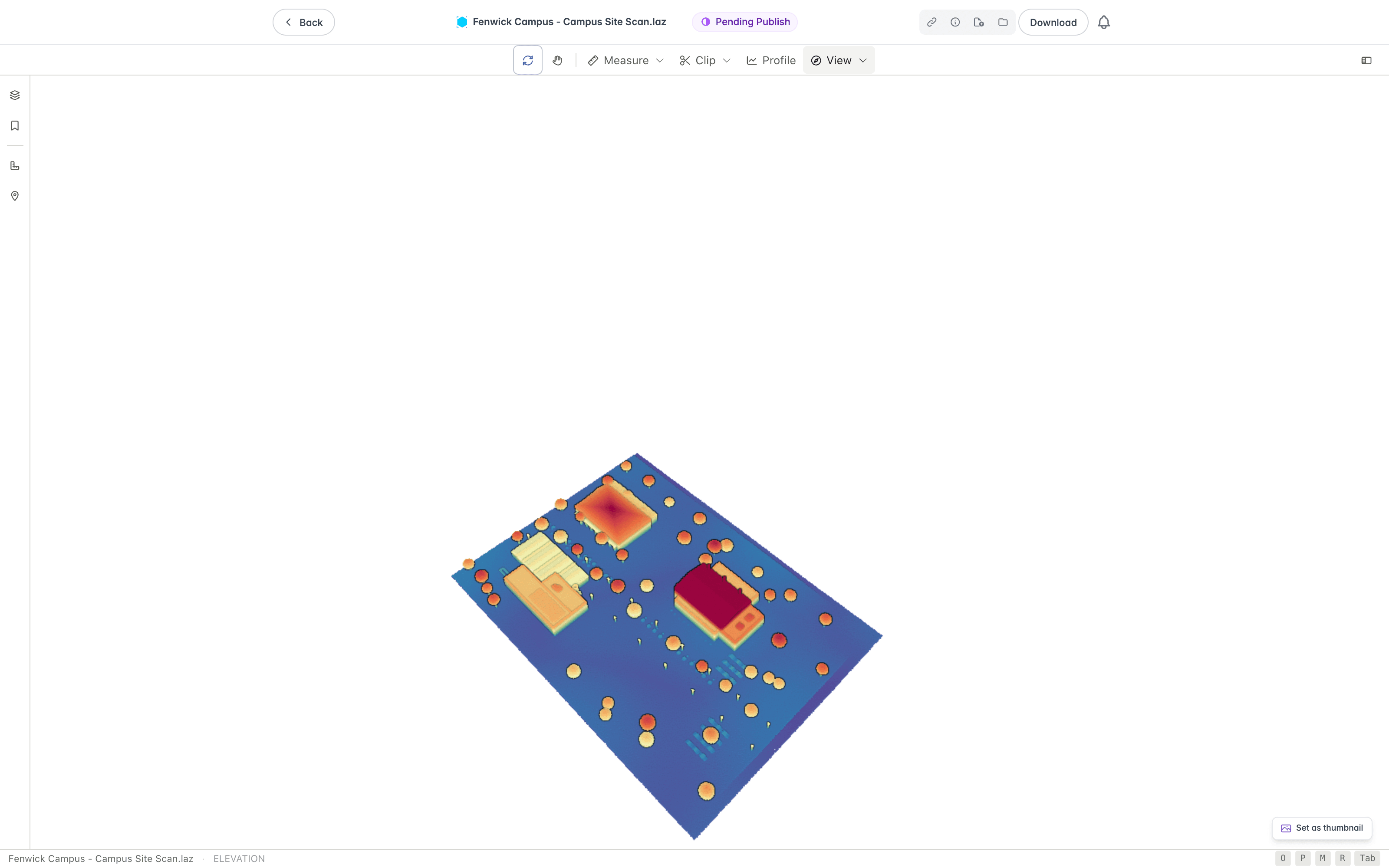
More attributes and fine-tuning options are in Settings, covered under Adjusting the Display.
Measurements
Open the Measure ribbon to measure the cloud. The tools are grouped as Length (Distance and Height), Shape (Area, Angle, and Circle), Volume (Volume), and Location (Point and Azimuth). The Measurements group has Labels, which shows or hides the labels on your measurements, and Clear all. Distance is selected when the ribbon opens.

To take a measurement, pick a tool from the Measure group, then click points directly on the point cloud surface to place markers. Each point snaps to the nearest scanned point. Every measurement you make appears in the Measurements panel, where you can zoom to it or remove it. Select Measurements → GeoJSON in the Measurements panel to export them as GeoJSON.
Distance
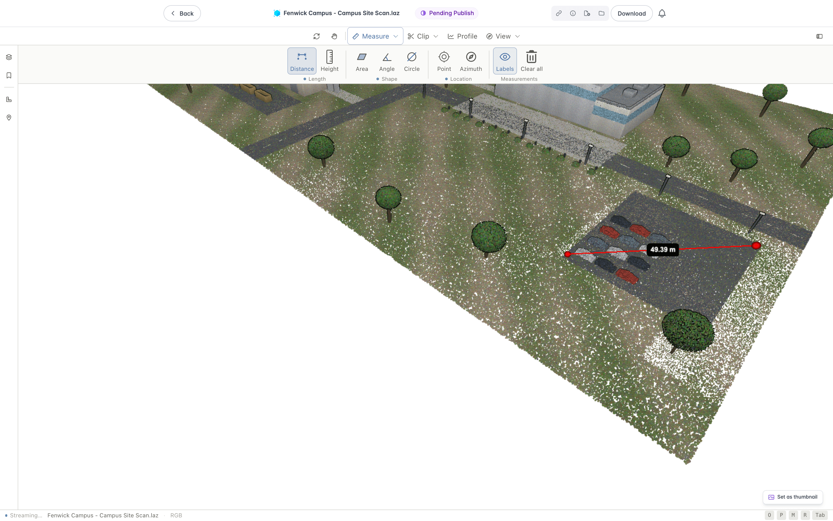
The Distance tool measures the straight-line 3D distance between two points, and the running total along a path of several points.
- Select Distance.
- Click the first point.
- Click each subsequent point along the path.
- Finish by right-clicking. Pressing Escape also stops, and keeps the measurement if it has enough points.
Each segment and the total length are labelled in metres. Use it for spans, clearances, pipe or cable runs, and setting-out lengths.
Area
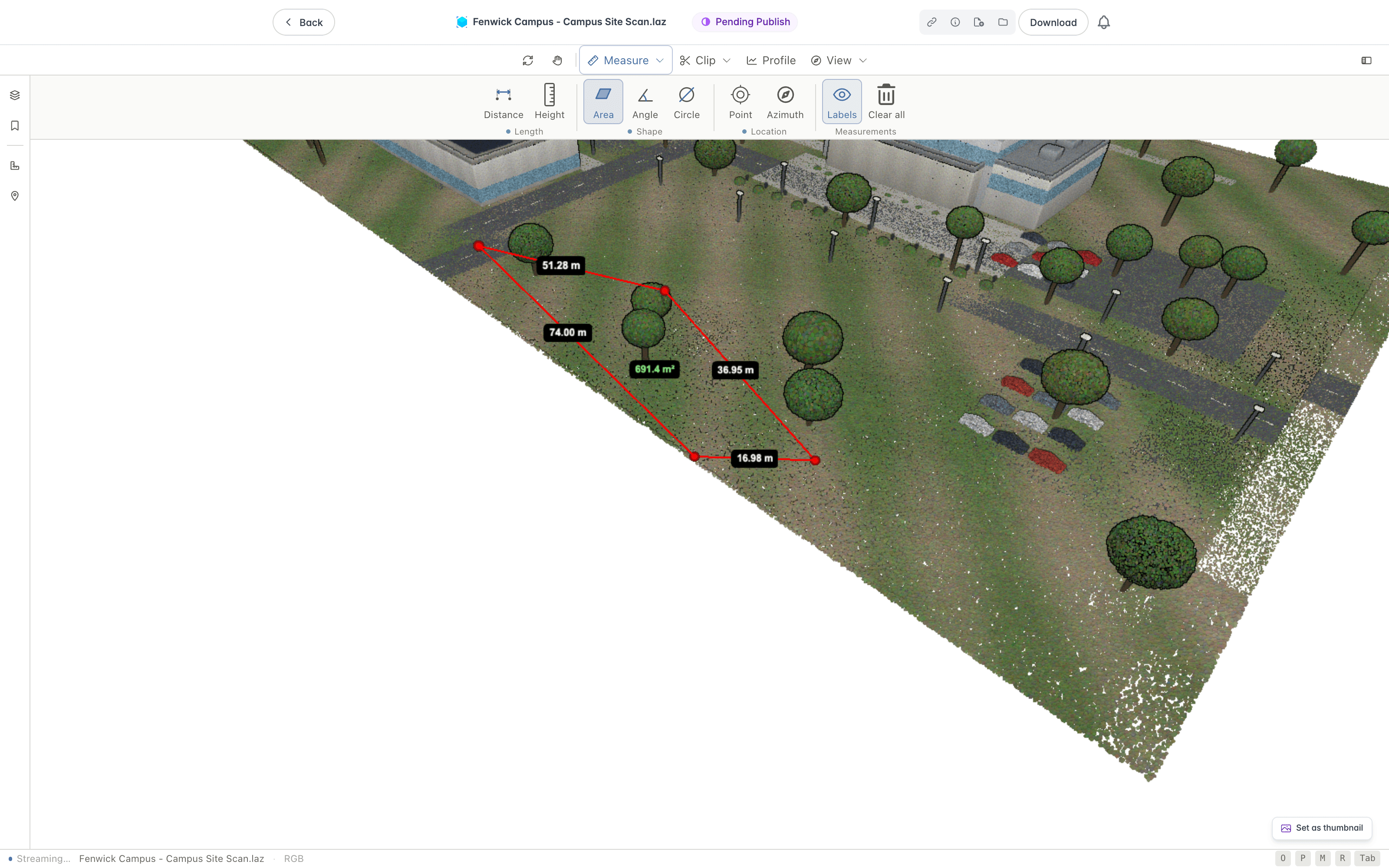
The Area tool measures the area of a polygon you draw by placing three or more points, which close into a face.
- Select Area.
- Click three or more points around the region you want to measure.
- Finish by right-clicking. Pressing Escape also stops, and keeps the measurement if it has enough points.
The enclosed area and the edge lengths are reported. Use it for footprints, hardstand or paving extents, lay-down areas, and quantity take-offs.
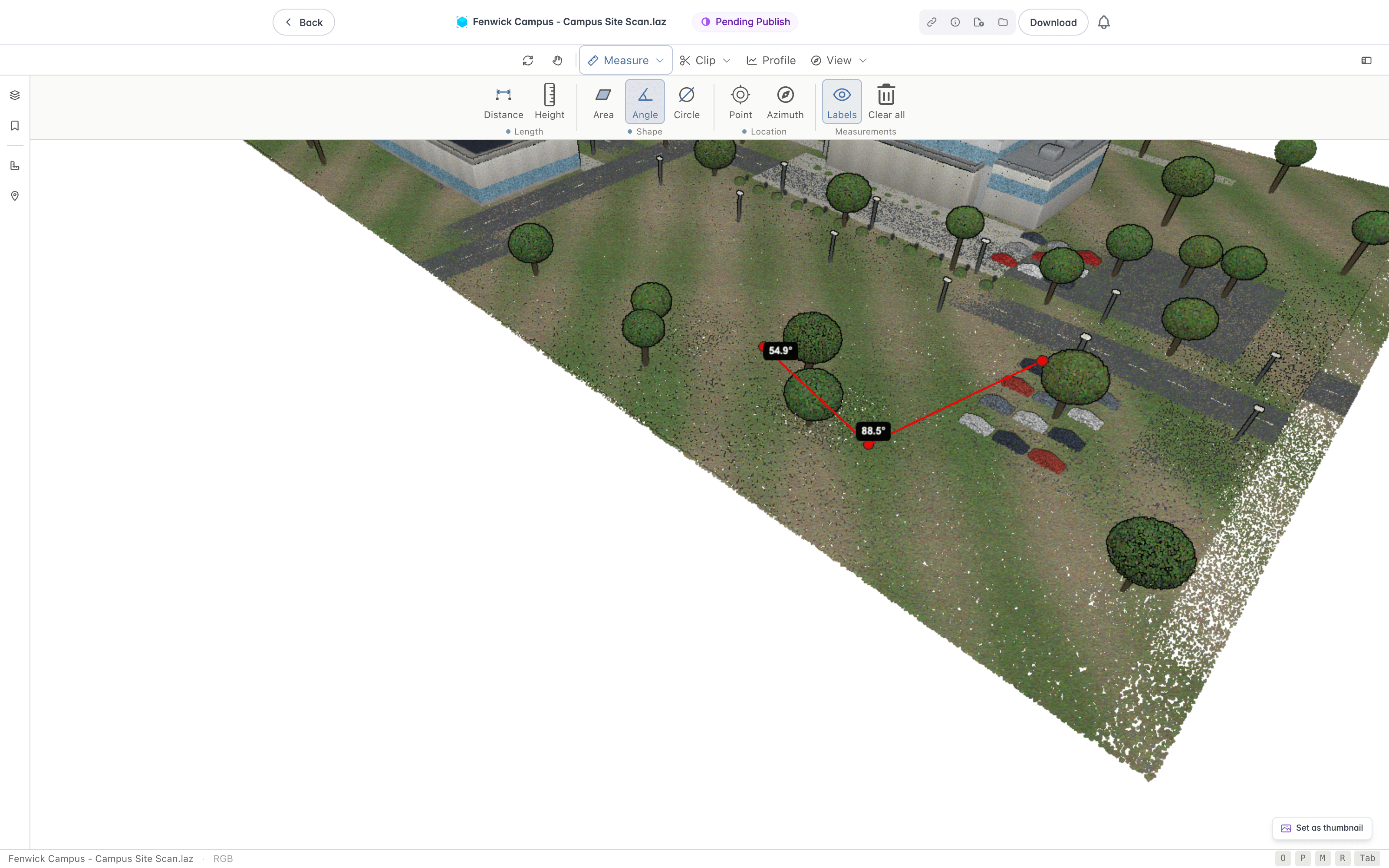
Angle
The Angle tool measures the angle formed by three points.
- Select Angle.
- Click the three points that define the corner.
The angle at the middle point is shown in degrees. Use it for slopes, batter angles, the angle between two walls or members, and checking corners.
Height
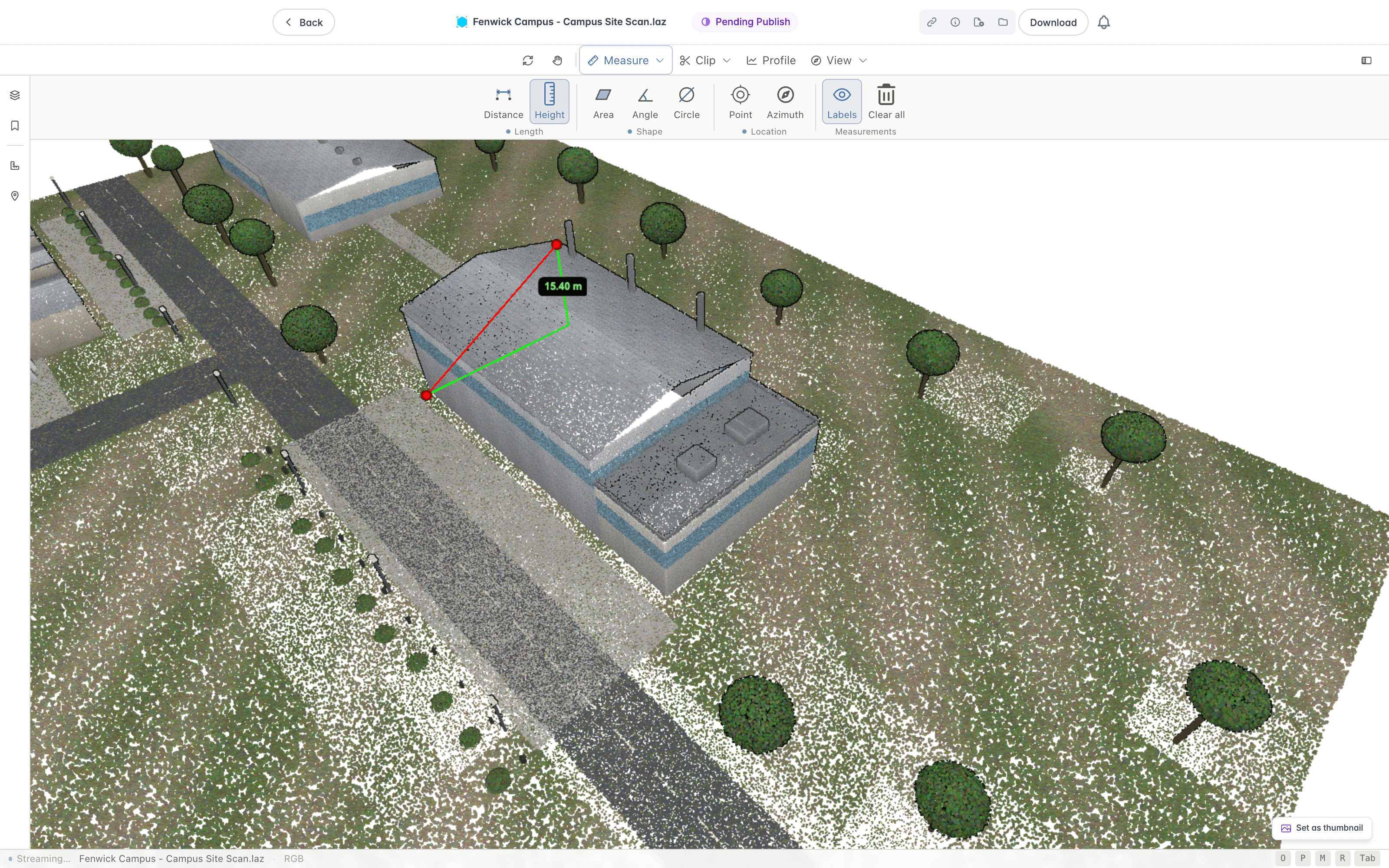
The Height tool measures the vertical difference in height between two points, independent of the horizontal distance between them.
- Select Height.
- Click the first point. A label at that point shows the height as you move the pointer.
- Click the second point.
It makes no difference which point you click first, whether the lower or the upper one. The vertical difference is shown in metres. The tool draws a red line between your two points, with green lines showing the vertical and horizontal parts of it, and labels the vertical part. Use it for floor-to-floor heights, structure or bank heights, level differences, and headroom.
Point
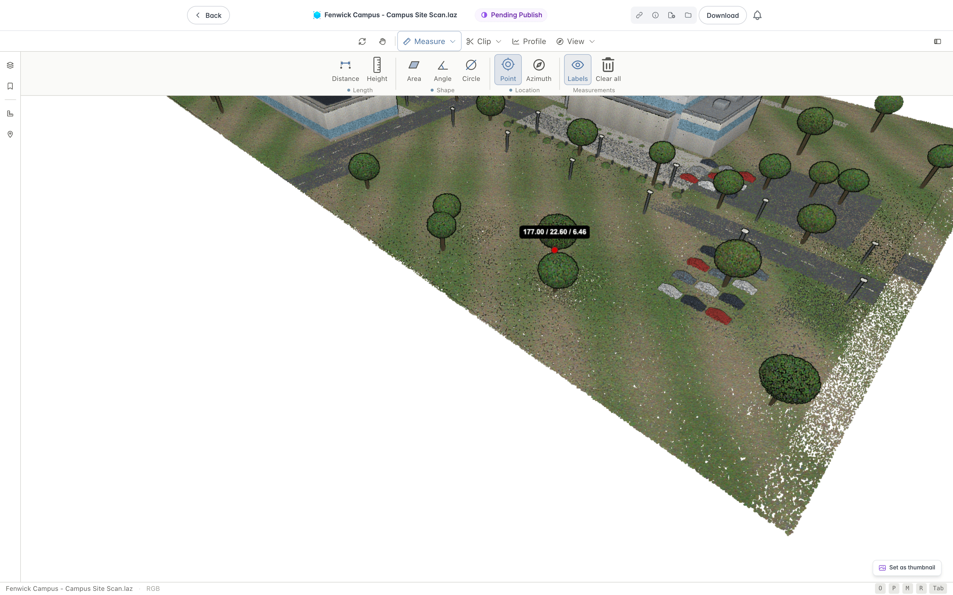
The Point tool places a single marker and reports its coordinates.
- Select Point.
- Click the feature you want to record.
The point's easting, northing, and elevation (X, Y, and Z) are shown. Use it for capturing the position of a feature, recording a control point, or reading a level.
Circle
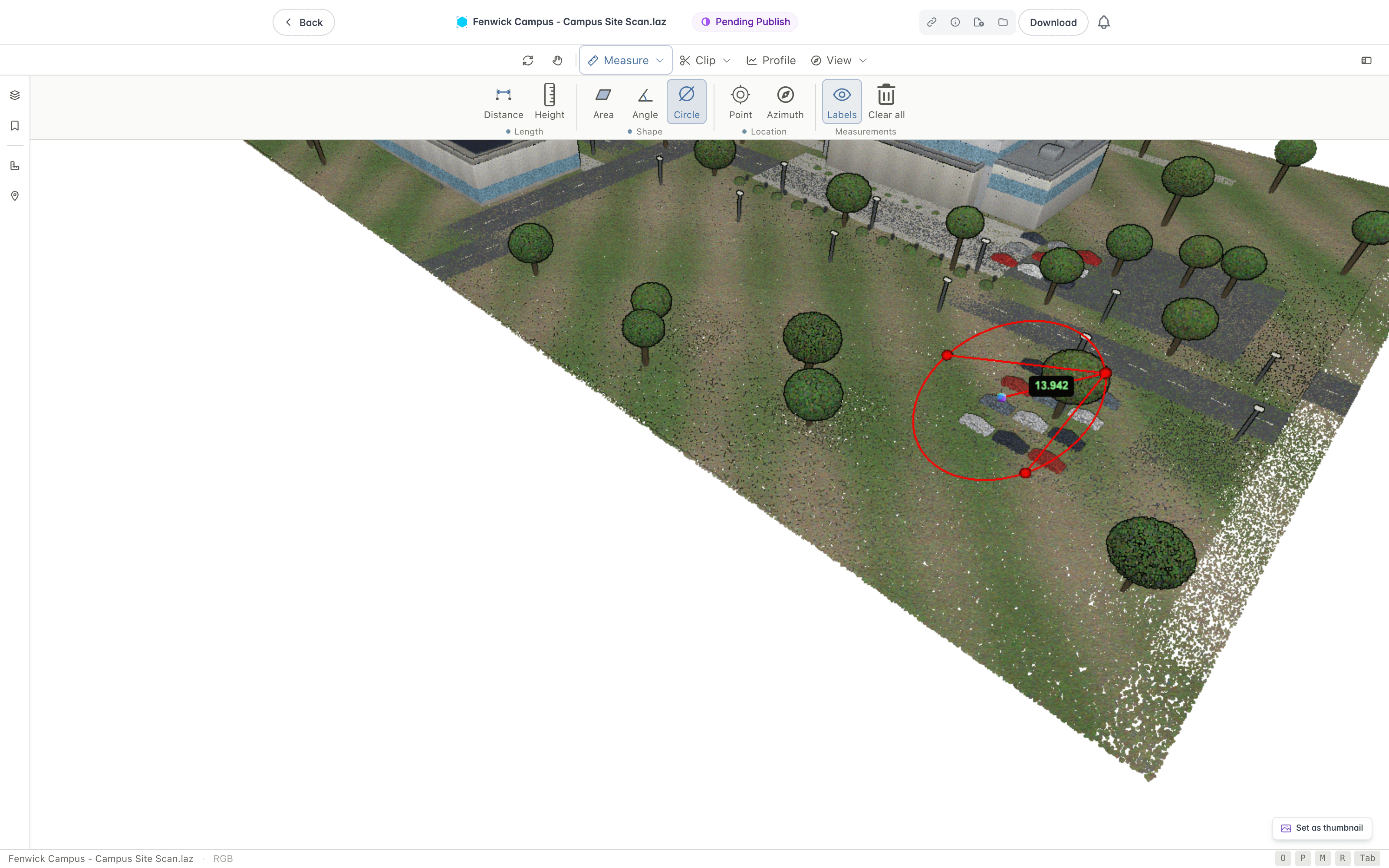
The Circle tool fits a circle through three points and reports its centre and radius.
- Select Circle.
- Click three points around the edge of the circular feature.
The circle's centre and radius are marked in the view. Use it for pipe or column diameters, curved kerbs, and circular tanks or manholes.
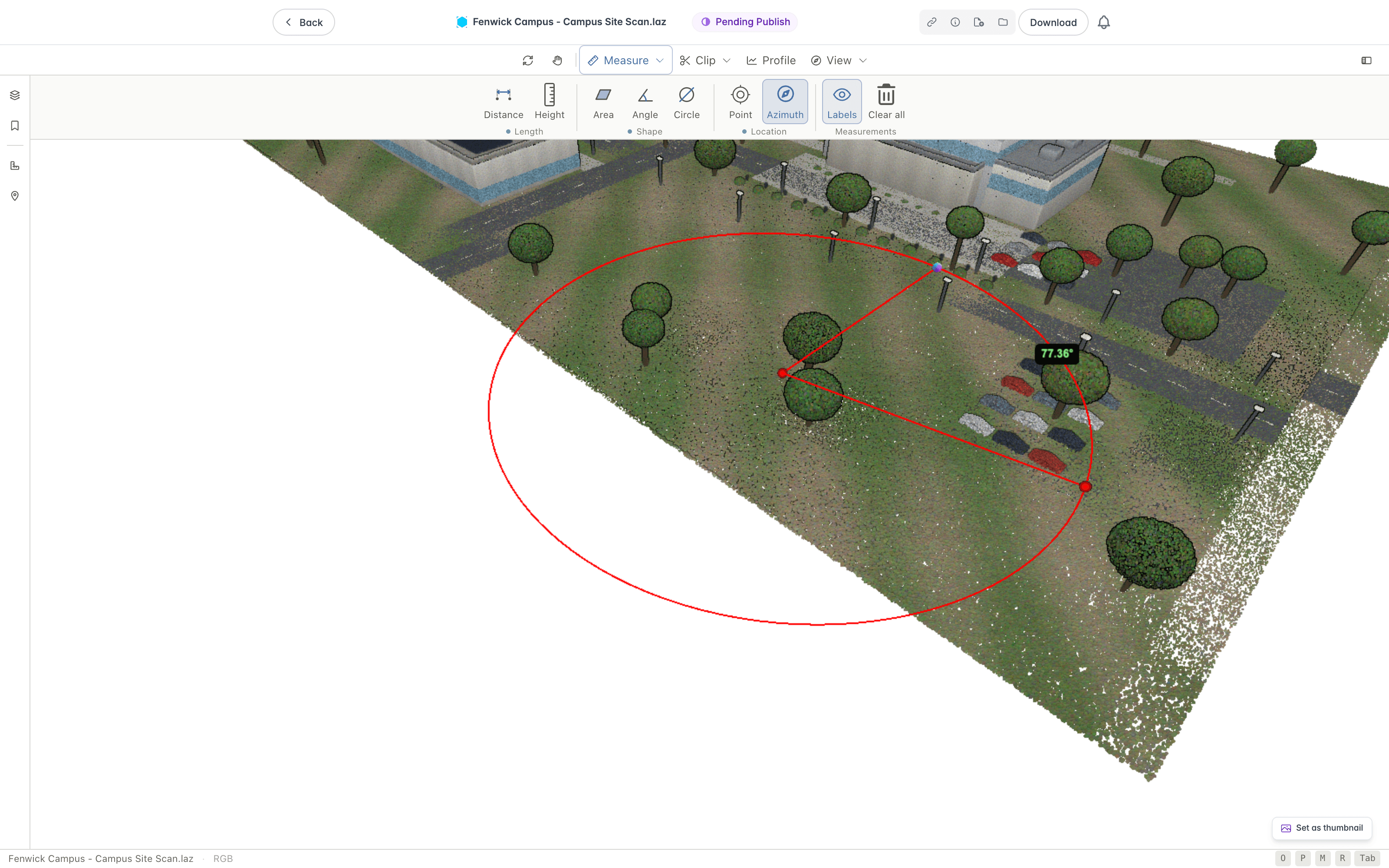
Azimuth
The Azimuth tool measures the horizontal bearing, or heading, from north between points.
- Select Azimuth.
- Click the point you are measuring from.
- Click the point you are measuring to.
The bearing from north is shown in degrees. Use it for the orientation of a feature, an alignment or setting-out direction, and checking headings against a plan.
Volume
The Volume tool measures the stockpile or pit inside an outline, as the volume between the cloud's surface and a base level.
- Select Volume.
- Click around the base of the stockpile or pit.
- Right-click to close the outline.
The result reads Net volume in cubic metres, with the volume Above base and Below base beside it, and a note of the coverage where parts of the outline have no points. Adjust how it is worked out in the measurement's details.
- Base is the level the volume is measured from: Fitted is a plane fitted through the surface at the outline's corners, Lowest is a level at the lowest corner, and Height is a level at a height you enter in the Base height field.
- Surface is how each cell's height is read: Mean uses the mean height of its points, and Top uses the highest point, which reads slightly high on slopes.
- Grid cell is the size of each cell, which is 0.1, 0.25, 0.5, or 1 metre.
Clipping and Sections
Open the Clip ribbon to isolate part of the cloud. Under Clip volume, choose Box, Sphere, or Polygon and draw the volume in the view, or select Fit view to add a box over what the view shows. Then, under Show, choose Off, Highlight, Show inside, or Hide inside to control what stays visible. Where there are two or more clip volumes, Inside offers Any, which counts a point as inside when it is in any volume, and All, which counts it only when it is in every volume. Clear all removes every clip volume.

Clip volumes are saved with the version of the point cloud and shared with everyone who opens it, so they are restored the next time you open that version. Saving is not available to everyone. Without it, your clips last only until you leave. If saved clips cannot be loaded, a message reads "Clips aren't saved".
The first time you open a version that has no clips, Lunr carries the clips of the nearest earlier version across, looking back up to ten versions, provided both scans use the same coordinate system. Where they differ, a message reads "Clips not carried forward" and the clips stay with the earlier version.
Where your organisation uses coordination issues, and you can create them and are allowed to mark up documents, a clip also offers Make issue from this clip, and the Annotations panel offers Make issue on its row. The issue is pinned at the centre of the clip, takes the clip's name as its title and the clip's note as its description, and the clip then shows the issue.
Use Profile to extract a cross-section through the cloud.
Clip Volumes Panel
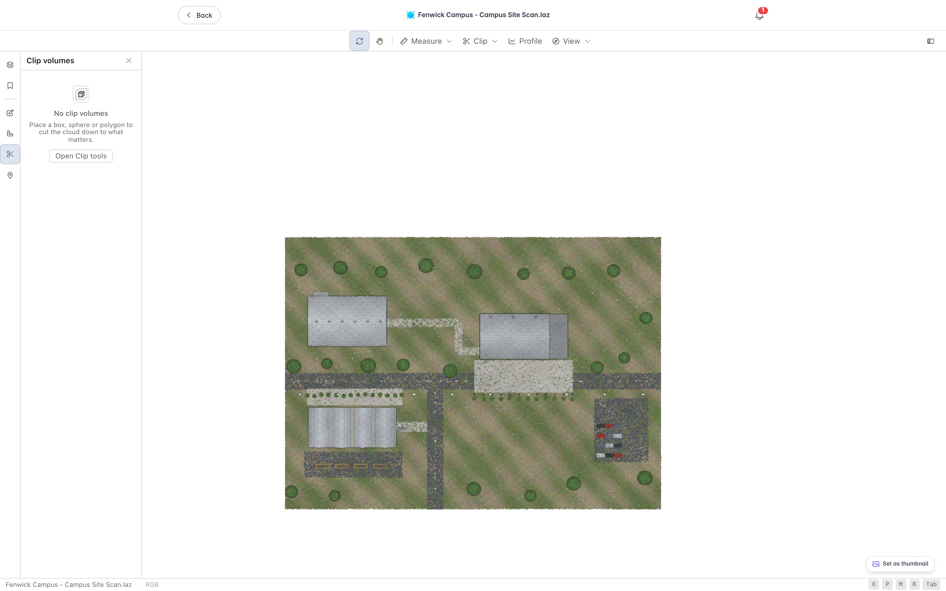
The Clip volumes panel lists every clip volume on the cloud, with a count in its header. Place a box, sphere, or polygon and it appears here. An empty panel reads "No clip volumes" and, while the Clip tools are closed, offers Open Clip tools. The label icon in the header shows or hides the volume names in the view. A line beneath the header says what the clips are doing, for example "Highlighting points inside".
Each row names the clip and its size, with a badge where it has an issue or a note. Double-click a name, or press F2, to rename it. The row buttons measure its volume, zoom to it, delete it, or hide it and stop it clipping, and Clear all at the foot of the panel removes every clip volume.
Select a clip to open its cards.
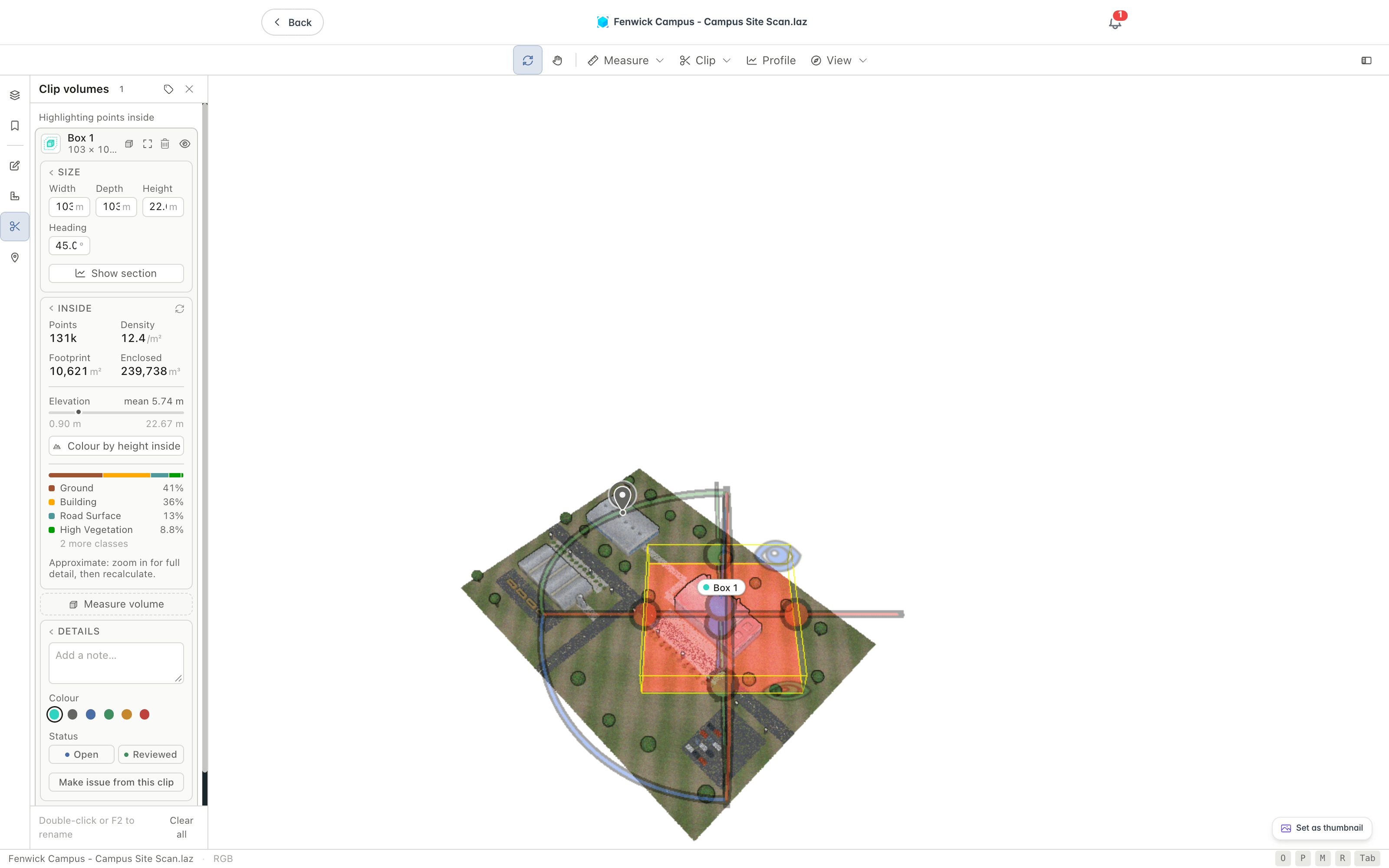
- Size gives a box's Width, Depth, Height, and Heading, a sphere's Diameter, or a polygon's Outline. Change a value to resize the clip. A polygon has no values, so drag its points in the view to reshape it. For a box, Show section plots the points inside as a section, drawn as distance along the box against height.
- Inside reports what the clip holds: Points, Density, Footprint (Cross-section for a sphere), and either Enclosed volume or Height range. Beneath them are the elevation range with its mean, a Colour by height inside button, and a breakdown of the points by class. Only the points currently loaded are counted, so zoom in for full detail and then select the recalculate icon.
- Measure volume measures the stockpile or pit inside a box or polygon, with the same Base, Surface, and Grid cell options as the Volume measurement. A sphere has no flat footprint, so it cannot be measured this way.
- Details holds a note field, a colour, a status of Open or Reviewed, and where you can raise issues, Make issue from this clip. Press Ctrl+Enter to finish a note.
- Export saves the clip's footprint as GeoJSON, KML, or DXF, and the points inside as a CSV file. The CSV holds the points as loaded at the current level of detail, up to 2 million, so zoom in first for more detail. KML needs a georeferenced cloud.
Adjusting the Display
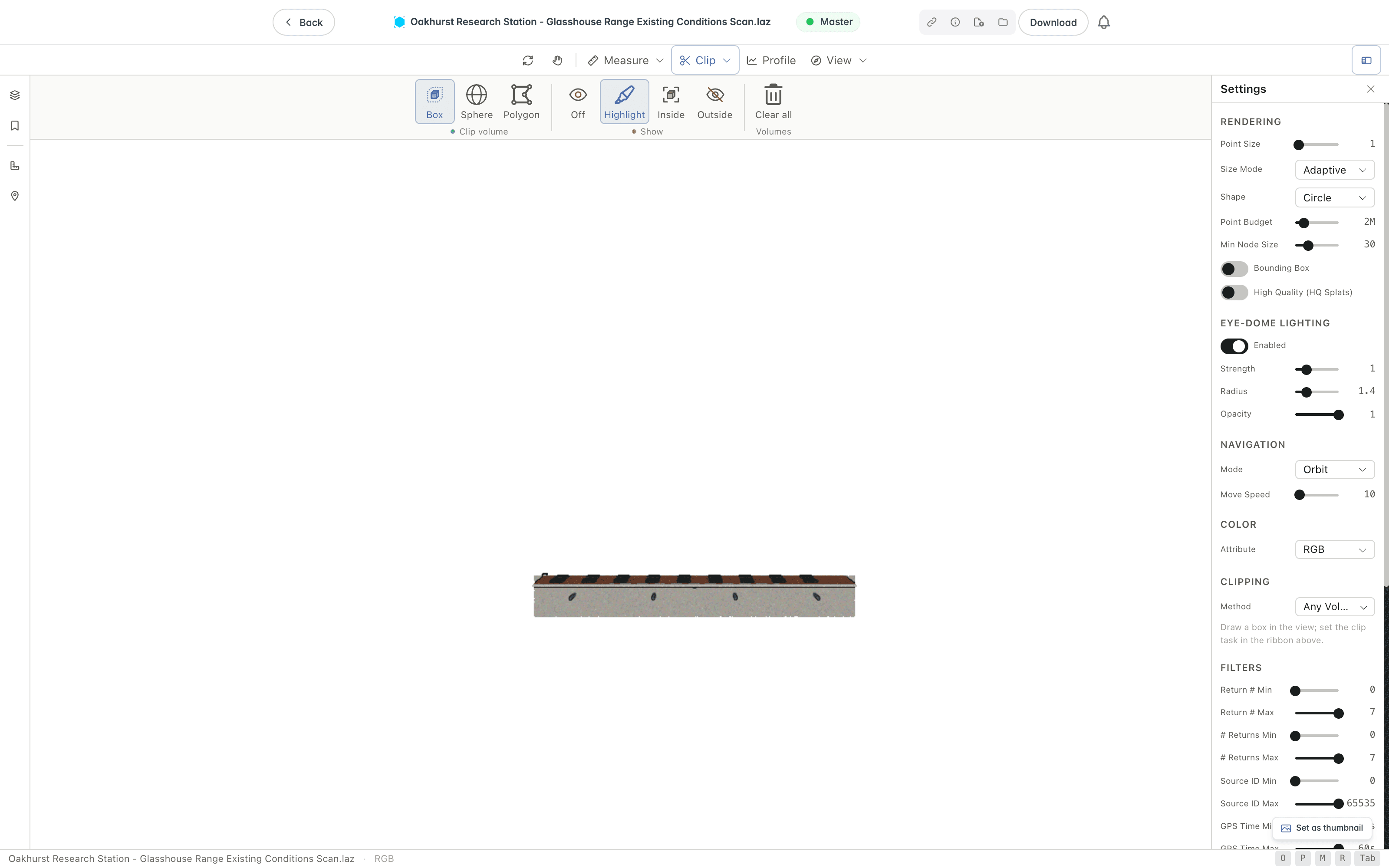
Open Settings to change how the cloud is drawn. From here you can set the point size and shape, adjust the point budget, adjust Eye-Dome Lighting, which is enabled by default and gives a clearer sense of depth, and filter points by return, source, GPS time, and LAS classification.
The Navigation section sets the navigation mode: Orbit, Earth, Fly, or Helicopter. Use Move Speed to change how fast the camera travels.
Working With Scenes
When a scene holds more than one point cloud, open the Scenes panel to work with each cloud. You can show or hide a cloud, adjust its opacity, and zoom to it. A scene is a collection of point cloud documents that open together, covered in Scenes. When you open a scene from one of its documents, only that cloud is visible at first. The other clouds are listed in the panel and hidden until you show them.
Saving Viewpoints
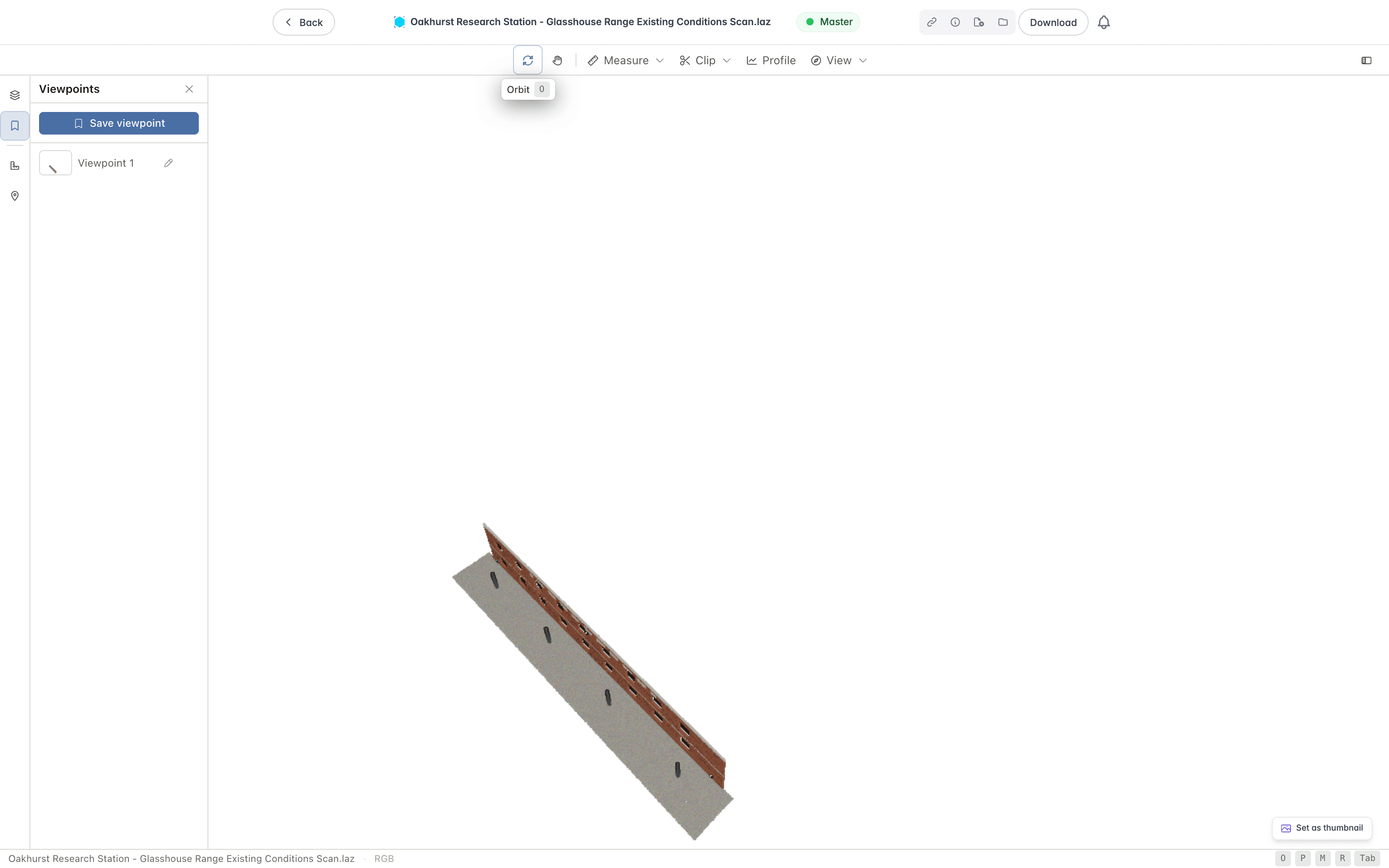
A viewpoint stores the camera framing and projection, the colour mode and display settings, the filters, which clouds are shown, and any clip volumes, so you can return to the same view later. Applying a viewpoint restores all of these, and if it holds clip volumes, they replace the clips currently on the cloud. Use viewpoints to keep a set of standard views of a site, or to mark the spots you want to come back to while you work.
Open the Viewpoints panel from the left rail, or press V.
To save the current view:
- Frame the cloud the way you want it.
- Open the Viewpoints panel.
- Click Save viewpoint.
The new viewpoint is added to the panel with a thumbnail of the view and a default name. Each saved viewpoint has controls to apply, rename, and delete it:
- Click the thumbnail or name to apply the viewpoint and move the camera back to that framing.
- Click the Rename button to give the viewpoint a clearer name, then press Enter.
- Click the delete button to remove the viewpoint.
You can also right-click a viewpoint in the panel to Apply, Rename, or Delete it.
Viewpoints are saved in your browser on this device, so they stay available when you reopen the document in the same browser. They are not shared with other users.
Annotations
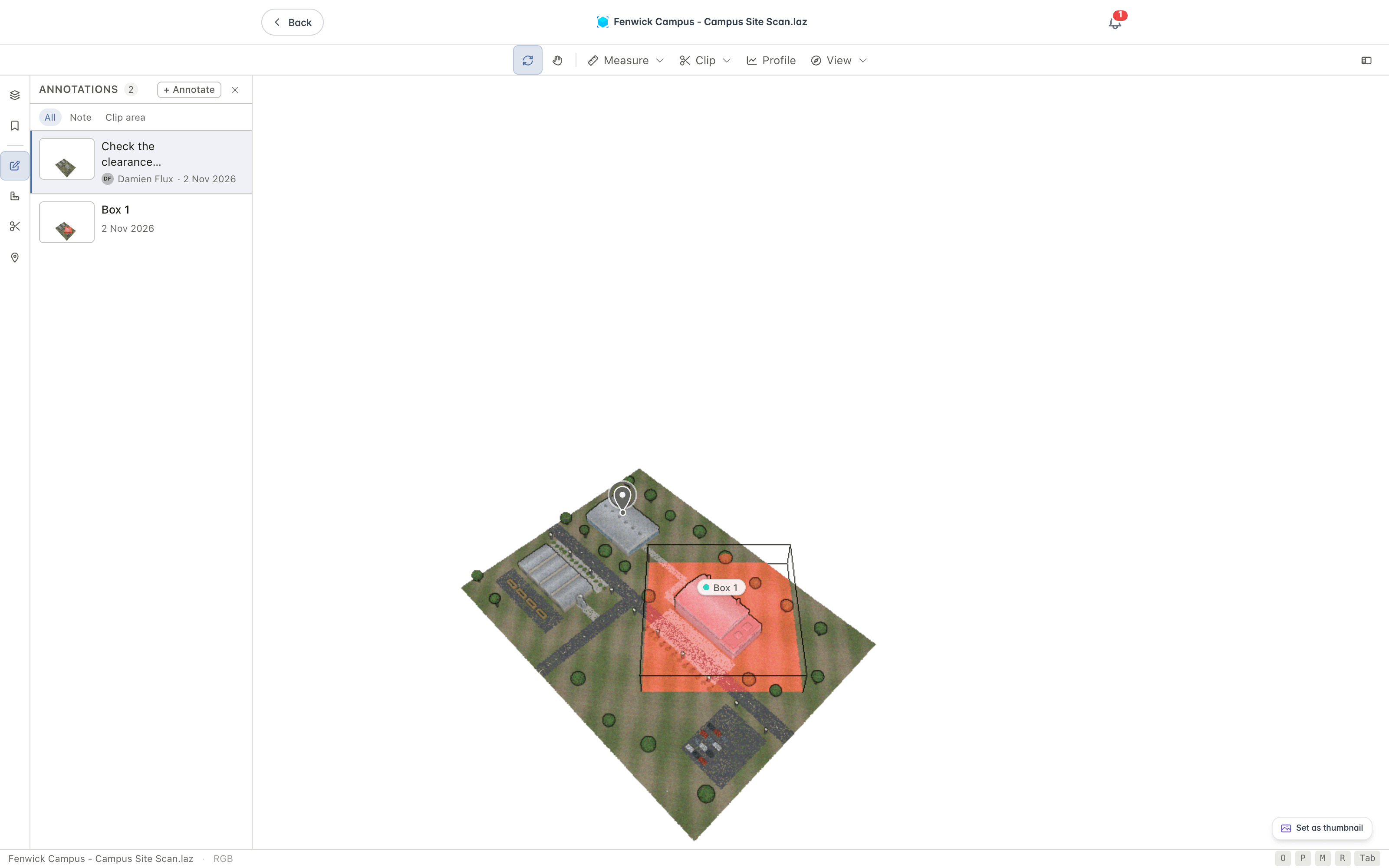
The Annotations panel is the review list for a cloud. It gathers its notes, clip areas, and saved views in one place, each with a thumbnail, its author, and the date. Open it from the left rail. Its header shows a count and an Annotate button. Once the list holds more than one kind of annotation, a row of filters narrows it to one kind.
Select Annotate, or right-click the cloud and choose Annotate, then choose what to add.
- Note pins a note to a point on the cloud.
- Clip area draws an area of interest as a clip volume.
- Viewpoint saves the current view.
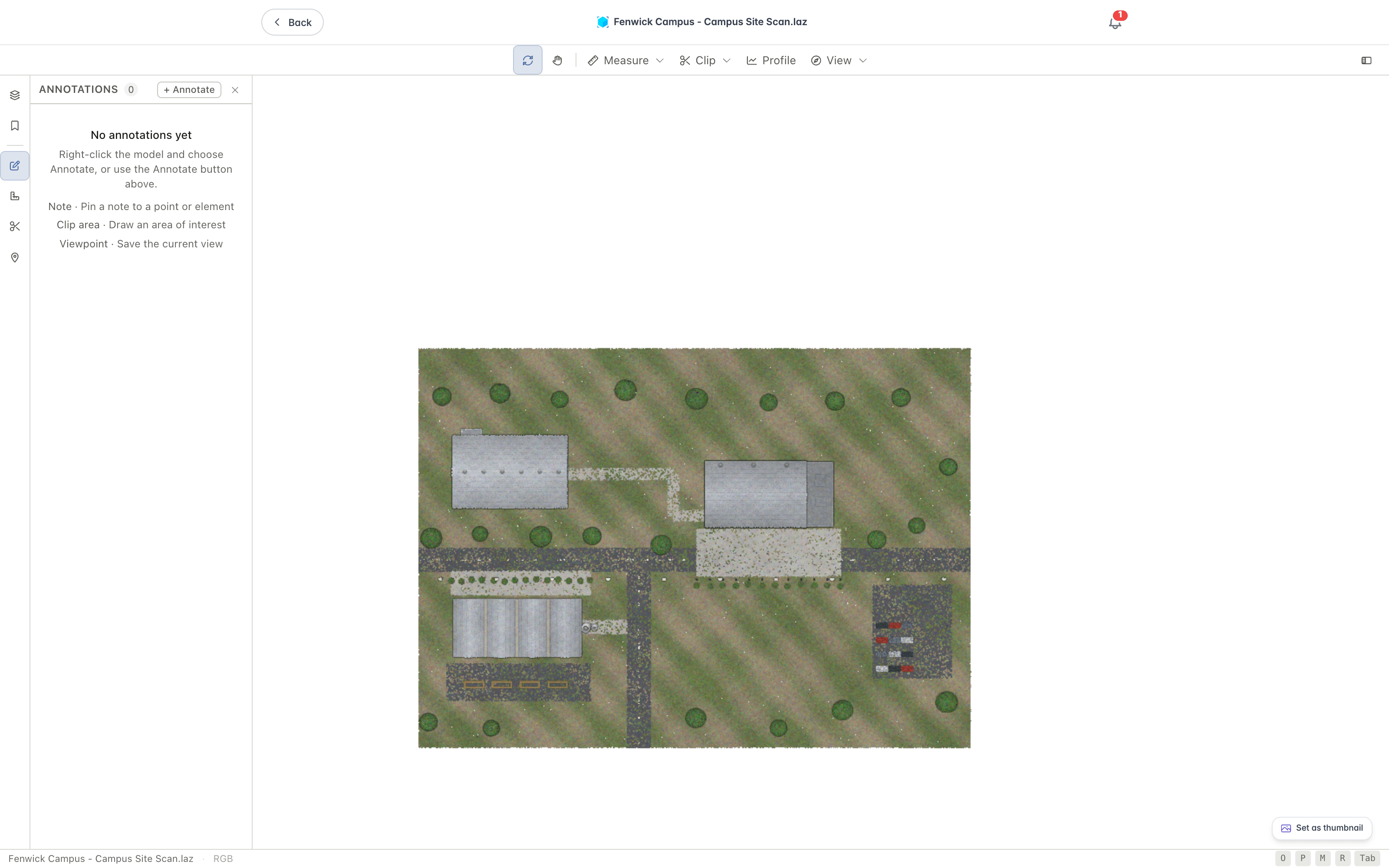
With nothing added, the panel reads "No annotations yet", and lists the three kinds with a hint for each.
Once there are annotations, each row shows a thumbnail, the title or the start of the note, its author, and the date. The filters above the list, All and one for each kind present, narrow it.
Notes
Choose Note, then click the cloud where the note belongs. In the Add a note dialog, enter the text in the Note field, up to 10,000 characters, and select Add note. The note appears as a pin on the cloud, and in the panel with its author and date. Everyone who can open the cloud sees it.
- Select a row to fly to its pin.
- Select Edit to change a note. The dialog then reads Edit note, and its button reads Save.
- Select Delete to remove a note. Lunr asks you to confirm, because everyone who opens the cloud loses it.
- Select Make issue to raise an issue pinned at the note, where your organisation uses coordination issues, and you can create them and are allowed to mark up documents. The note then shows the issue number.
Notes are saved with the version of the cloud. Adding, editing, and deleting notes is not available to everyone, and without it a message says you can view the document but not edit it. Changing or deleting someone else's note needs further permission. A cloud holds at most 200 notes. Notes stay with the version they were added to and do not carry forward to a newer one.
Clip areas and viewpoints in the list behave as described under Clipping and Sections and Saving Viewpoints. Selecting a clip row selects the clip and zooms to it, and selecting a viewpoint row applies it.
Capturing a Screenshot
Click Screenshot in the Capture group of the View ribbon, or press S, to save the current view as a PNG image.
If you are allowed to manage projects, select Set as thumbnail at the bottom right of the viewer to use the current view as the document's thumbnail. A message reads "Thumbnail updated".
The Right-Click Menu
Right-click anywhere on the point cloud to open a menu of common actions at the cursor. A stationary right-click opens the menu, while a right-click and drag still pans and zooms the view, so navigation is unaffected.
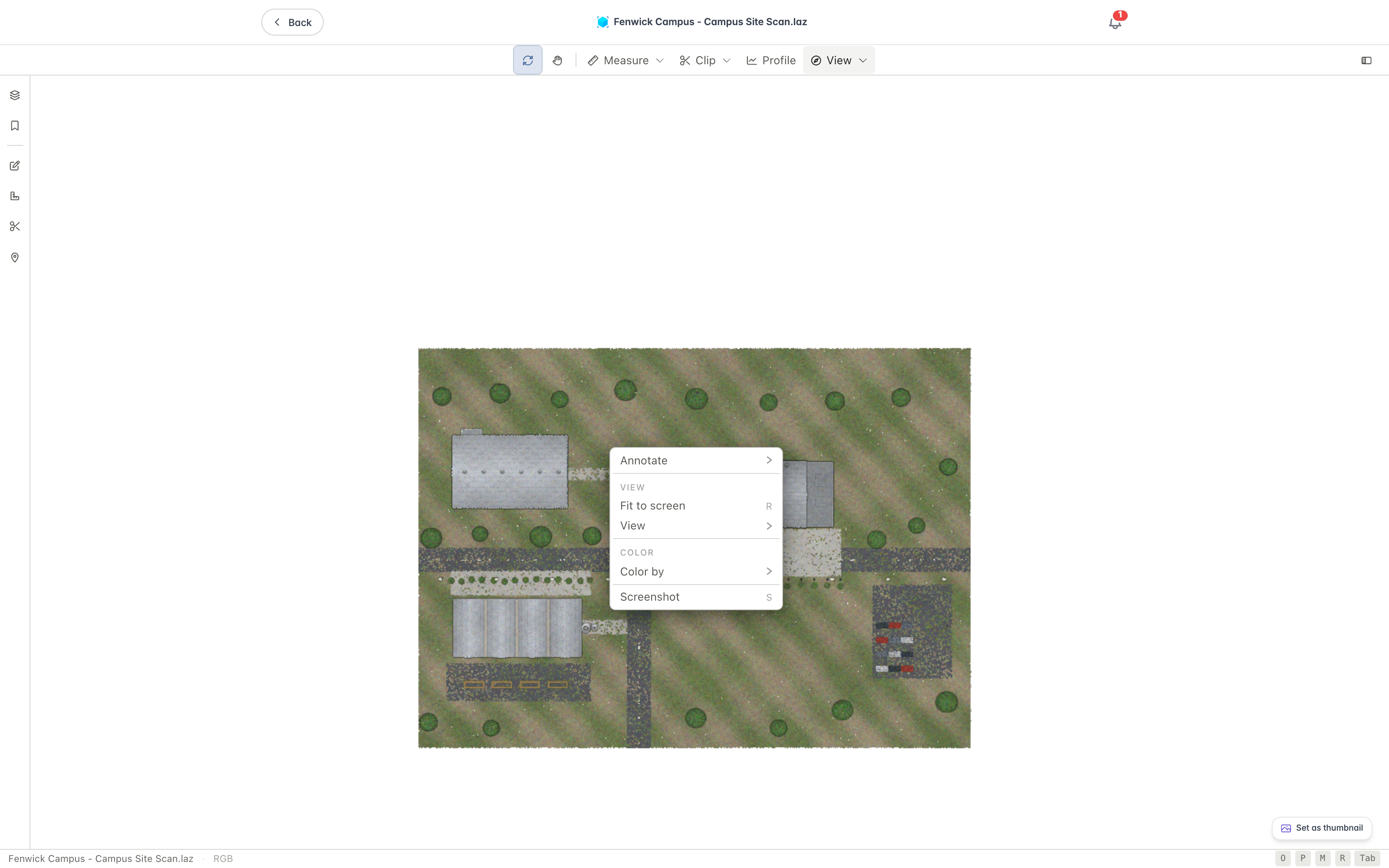
The menu gives you quick access to:
- Annotate to add a note, a clip area, or a viewpoint.
- Fit to screen to frame the whole cloud, which is also the R key.
- View to jump to the Top, Bottom, Front, Back, Left, or Right view, or switch between the perspective and orthographic cameras.
- Color by to recolour the points by RGB, Intensity, Elevation, Classification, Return Number, Number of Returns, Source ID, or GPS Time.
- Screenshot to save the current view as an image, which is also the S key.
Keyboard Shortcuts
- O - Orbit
- P - Pan
- M - Measure distance
- C - Clip volume
- R - Fit the whole cloud to the screen
- S - Screenshot
- V - Toggle the Viewpoints panel
- L - Toggle the Scenes panel
- Tab - Toggle Settings
- 1 to 4 - Colour by RGB, Intensity, Elevation, or Classification
- T - Toggle theme
Viewing CAD Models and Assemblies
View Inventor and SolidWorks parts and assemblies, STEP mechanical parts, and STL meshes in Lunr's browser-based 3D viewer, with tools for measurement, sectioning, saved views, assembly parts, bills of materials, issues, model states, and revision comparison.
Viewing Video Files
Play MP4, WebM, and MOV video files in Lunr's native browser-based video viewer, which streams the file so you can start watching and skip ahead without downloading it first.